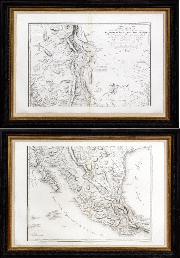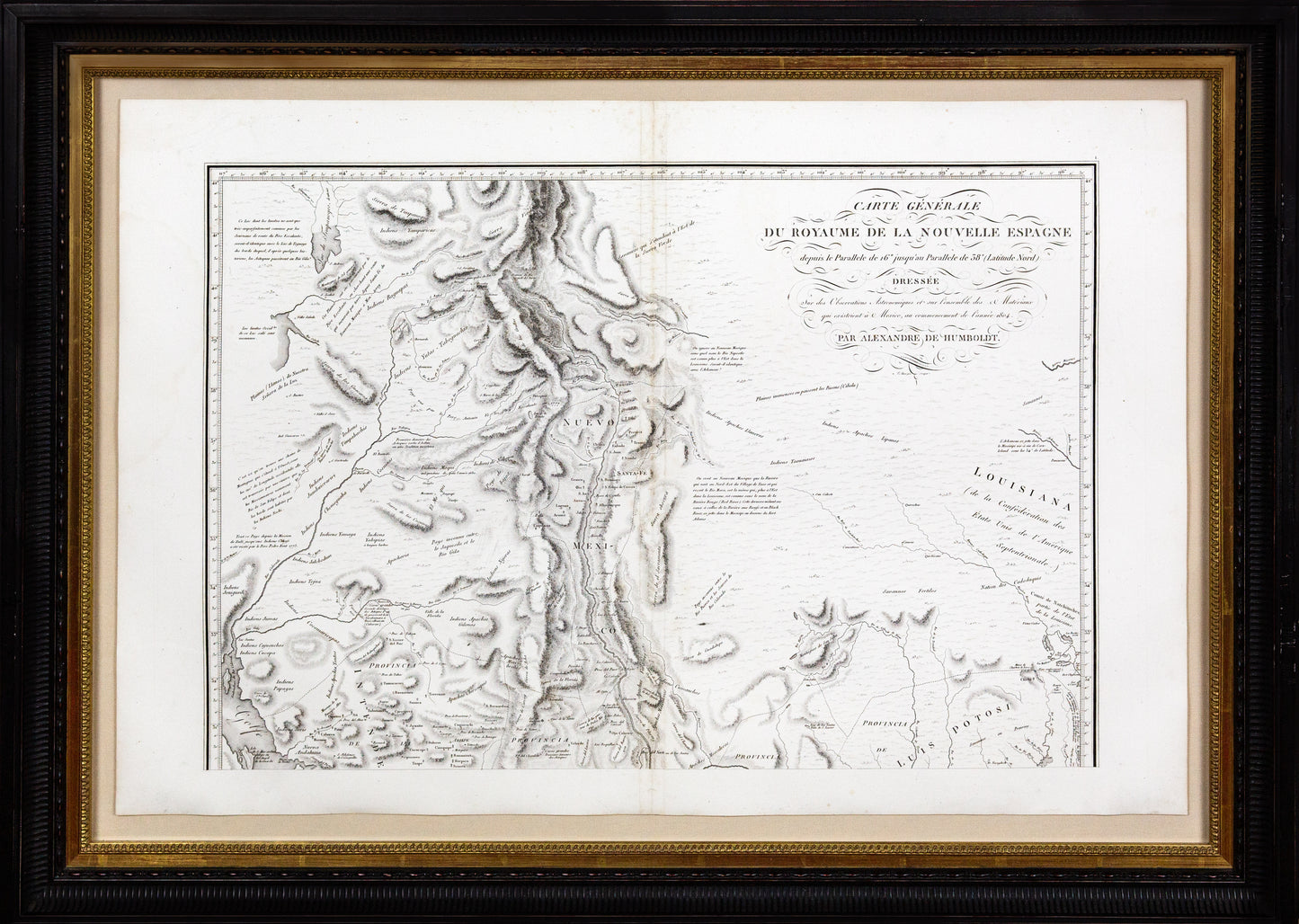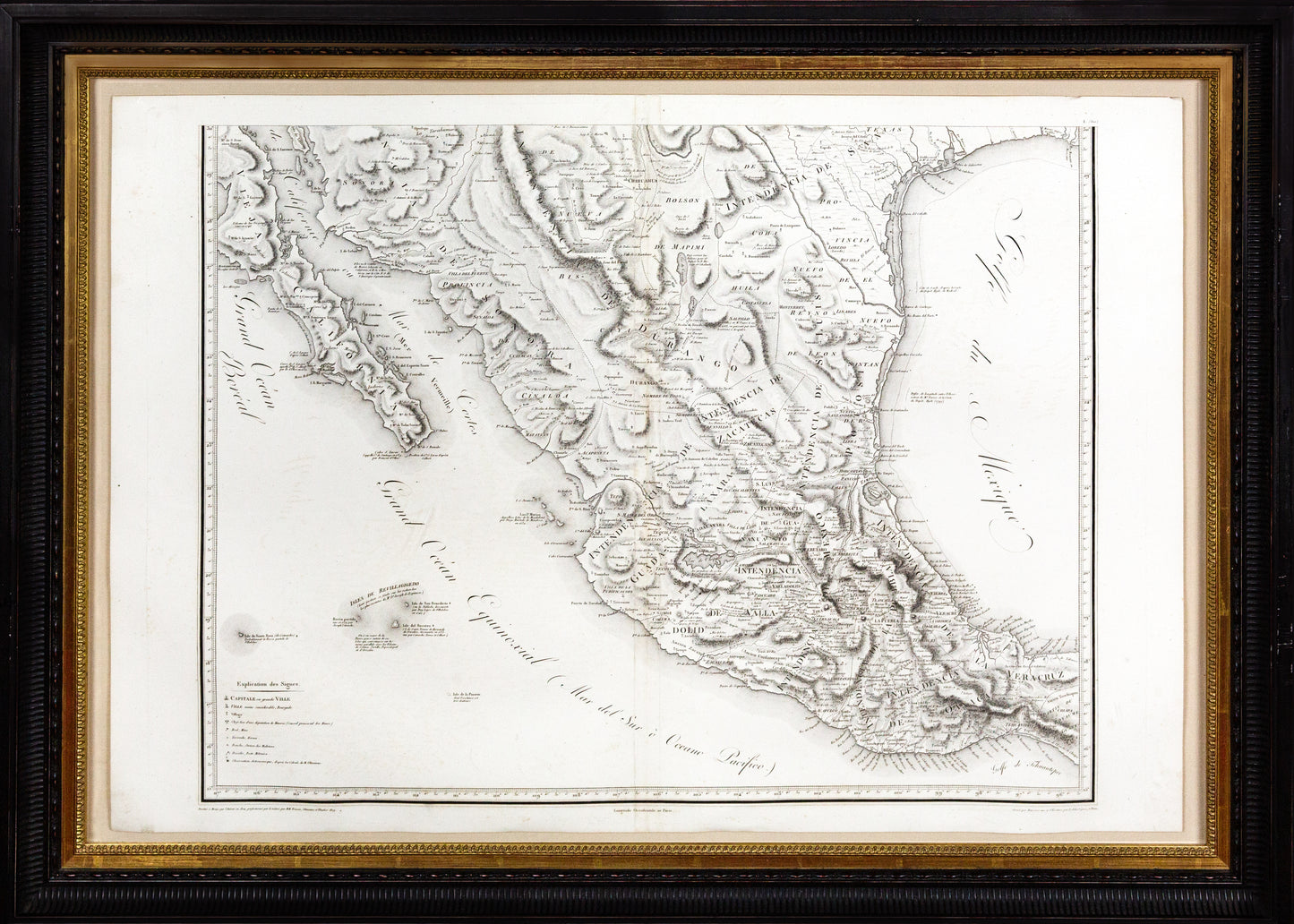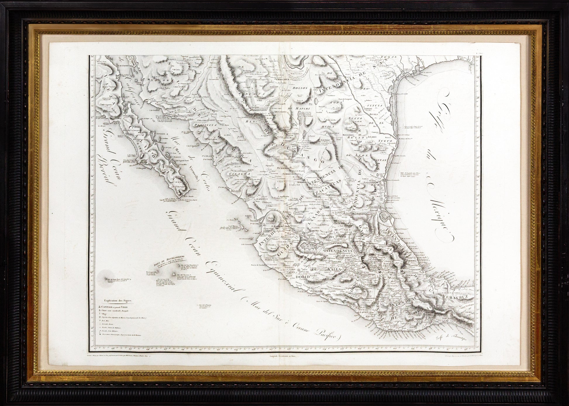
Alexander von HUMBOLDT (1769-1859), Carte Generale Du Royaume de la Nouvelle Espagne...., 1811.
Alexander von HUMBOLDT (1769-1859), Carte Generale Du Royaume de la Nouvelle Espagne...., 1811.
Couldn't load pickup availability
Alexander von HUMBOLDT (1769-1859)
Carte Generale Du Royaume de la Nouvelle Espagne....
Engraved map on 4 sheets joined as two
Paris: F. Schell, 1811
Sheet size: 22 x 32 ¾ inches each; Frame size: 29 inches x 39 inches
Humboldt’s map of New Spain was the first “modern” map of the Spanish dominions in North America, and the source map for a subsequent generation of cartographers.
Spanish law prohibited anyone from entering any of its vast North American territories without the prior consent of the government. Such consent was rarely granted, but the Prussian scientist Alexander von Humboldt obtained permission to visit New Spain, directly from King Charles IV in Madrid. His passport was almost without restriction - a degree of access never having been provided to a foreign visitor before.
Scientific exploration was Humboldt’s express purpose, and it was the rationale behind the unusually broad passport. His experience as a mineralogist and work in the mining industry certainly helped, as Charles was hopeful that Humboldt’s investigations might lead to improvements in colonial mining practices. Furthermore, Humboldt’s ability to completely fund the exhibition himself certainly must have bolstered his appeal. His only obligation in return for the expansive permission was to send all of the specimens he might collect to scientific institutions in Madrid.
Between 1799 and 1803, Humboldt and his botanist companion Aime Bonpland traveled extensively through modern day Venezuela, Columbia, Ecuador, and Peru, ending their journey in Mexico City. There, Humboldt spent nearly a year consolidating his collections and began drafting his “Political Essay on the Kingdom of New Spain.” One of the great achievements of this work was the map that accompanied the book: the Carte Generale du Royaume de la Nouvelle Espagne. Often described as the first “modern” map of Mexico and the American Southwest, the map was a combination of work of by other cartographers and the astronomical and physical observations made by Humboldt himself. One of his sources of note was La Fon’s map of Louisiana. Humboldt also incorporated information provided by indigenous inhabitants of the region, both factual and mythological.
Humboldt could not avoid the dispute about the boundaries of the United States following its purchase of Louisiana. He identified the Sabine River as “the eastern border of Texas” but duly noted that it was “not recognized by the Congress in Washington.” When the map was published in 1811, the resolution of the eastern border was still eight years away. Within Mexico itself Humboldt’s map shows the western border of the Province of Texas as running northwest from the mouth of the Nueces River to a point on the border of the Province of Coahuila. The area between the Nueces and the Rio Grande was described as part of the Province of Nueva Santander – later famous as the Nueces Strip.
Humboldt’s map broke new ground in the physical mapping of modern-day California, Nevada, Arizona, New Mexico, Colorado and Texas. After leaving Mexico, Humboldt visited the United States where he gave a copy of his map to then President Thomas Jefferson. Jefferson, in turn, gave copies to his teams of explorers - among them, Zebulon Pike. Humboldt later complained that Pike had plagiarized his map in preparing Pike’s own account of his explorations.