Aaron Arrowsmith. A Map exhibiting... North America...1811.
Aaron Arrowsmith. A Map exhibiting... North America...1811.
Regular price
$ 35,000.00 USD
Regular price
Sale price
$ 35,000.00 USD
Unit price
per
Couldn't load pickup availability
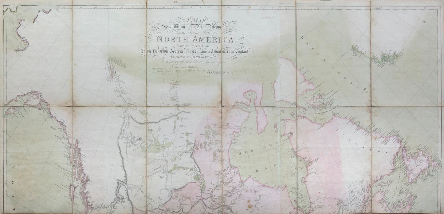
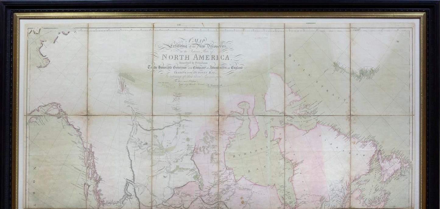
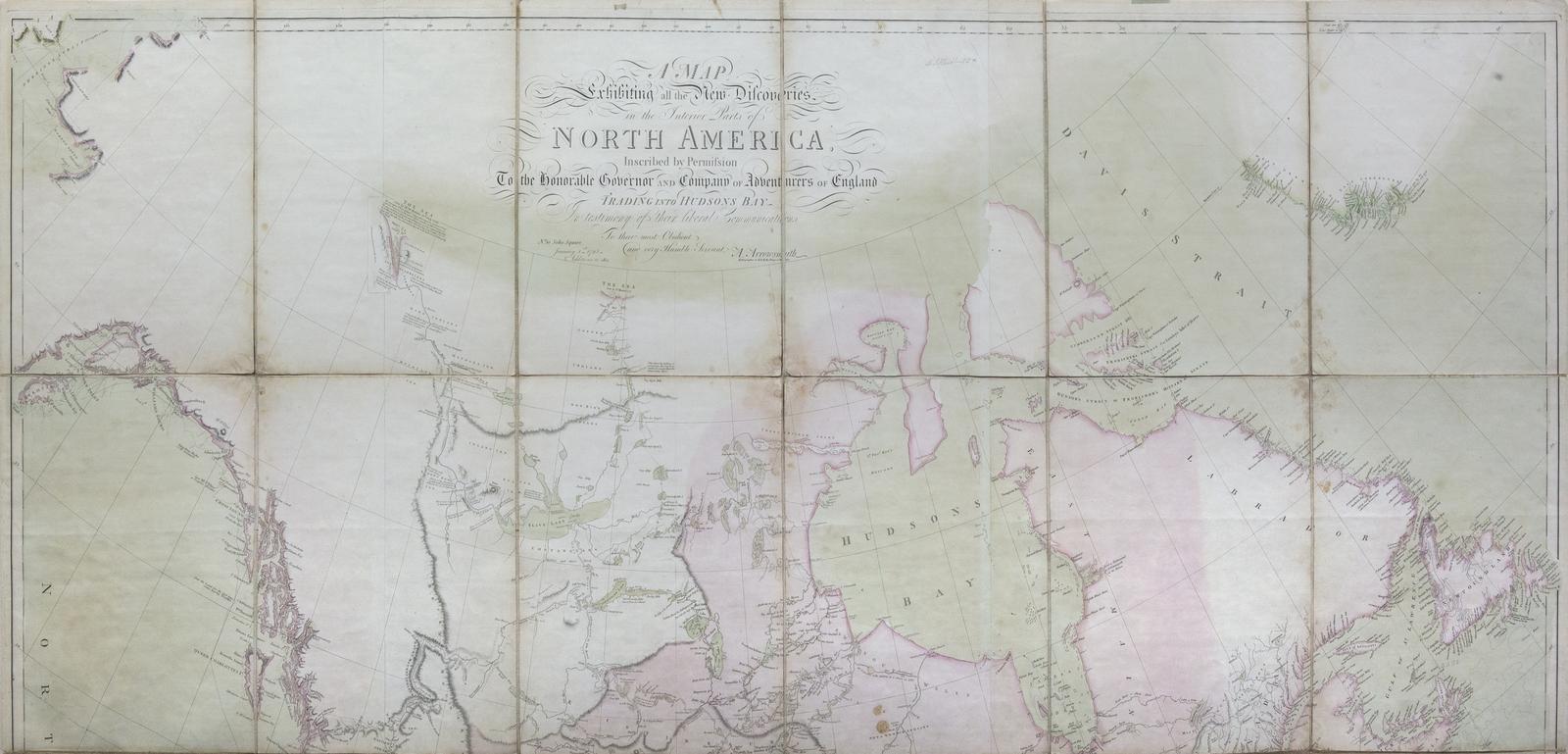
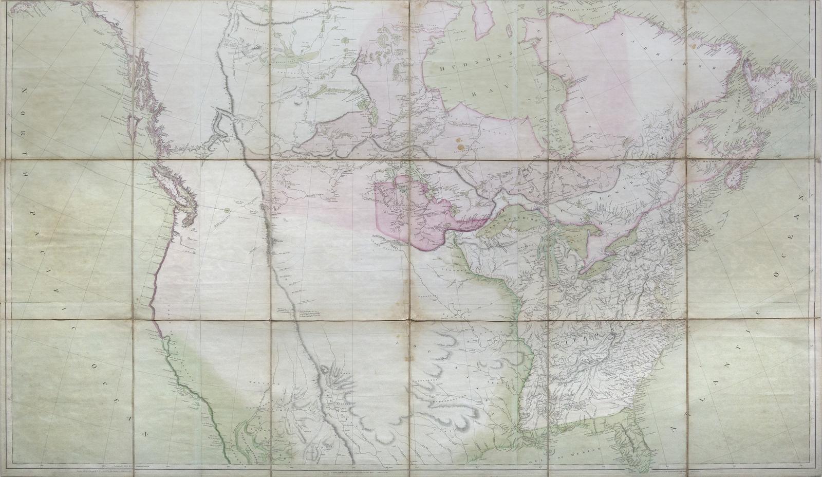
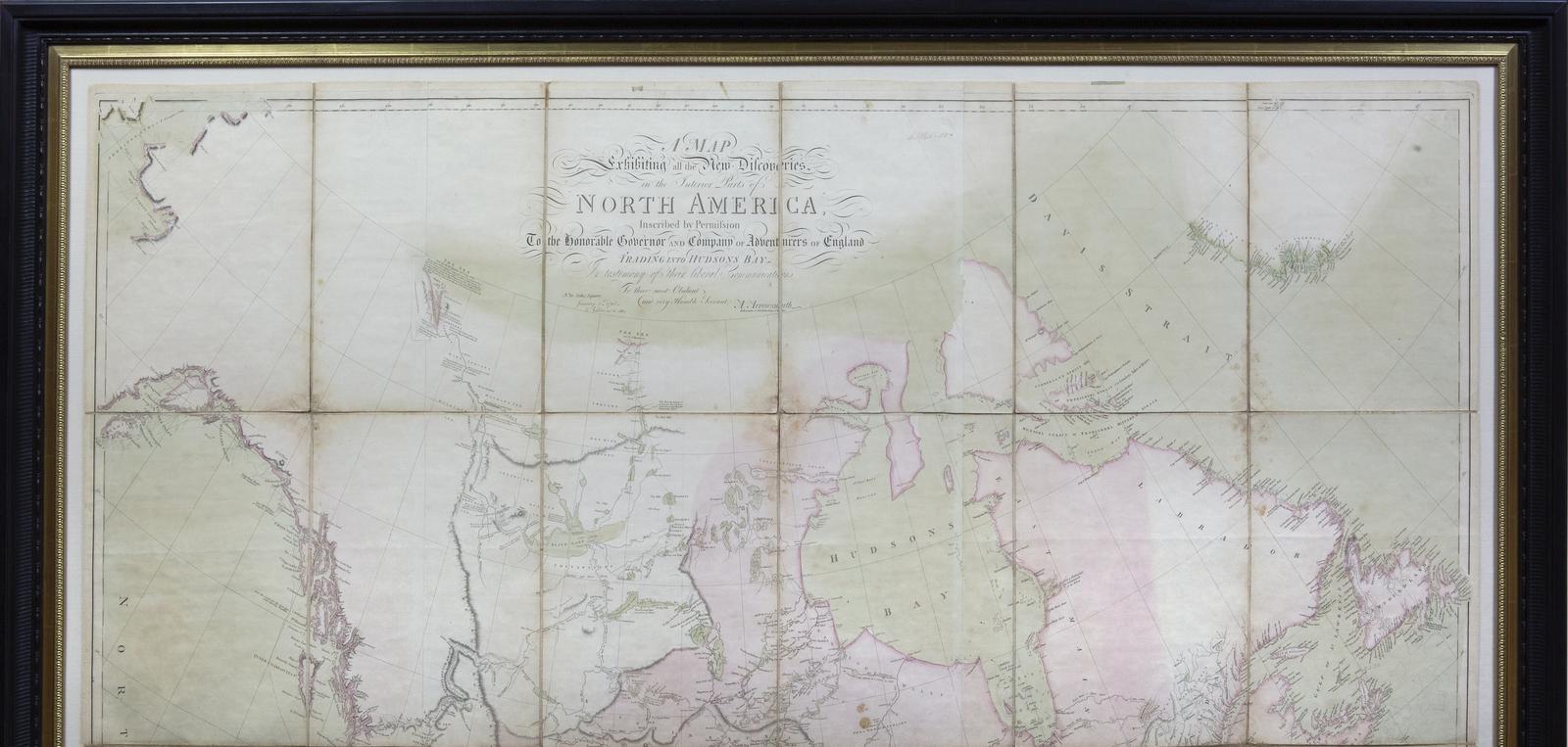
ARROWSMITH, Aaron (1750-1823).
A Map exhibiting all the new discoveries in the interior parts of North America... 1795, with additions to 1811.
Engraved map with original hand color in full.
London: Arrowsmith, 1811.
50" x 58 1/4" sheet, 57" x 65" framed.
Arrowsmith was the best mapmaker in the world at the beginning of the 19th Century.
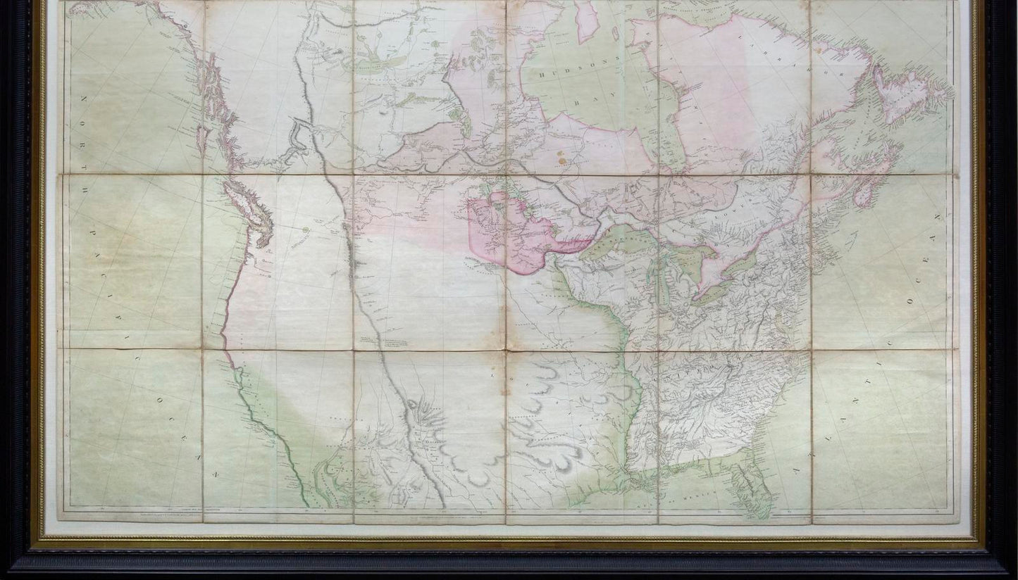
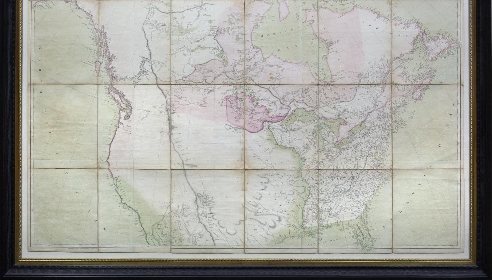
Full color example of Aaron Arrowsmith's map of North America, one of the seminal maps for the early history of the Transmississippi West and the primary map utilized by Lewis & Clark (1802 edition).
The eighth issue of Arrowsmith's important and evolving map, updated over the years as new information on the geography of North America came to light, relying on exploring expeditions and other sources, and extensively on the fur traders and trappers of the Hudson's Bay Company.
The present issue makes changes and additions to the waterways in Canada. The scale on the map is one inch equals 60 geometrical miles. The map extends south to 29' and in the west to Cook's Inlet, as with the first 1802 issue. Cook's tracks are shown. The projection is no longer a simple conic; south of 40' the meridians begin to curve in. For a description of early issues of this map of this, see Warren Heckrotte, "Aaron Arrowsmith's Map of North America and the Lewis and Clark Expedition" in The Map Collector 39, Summer 1987.
References: W-TW 231. Tooley, MCC, 68, #134. Heckrotte, TMC, 6/87 where the best description of early issues of this map is given. Heckrotte, TMC, 52, 9/90, p47.
View full details
A Map exhibiting all the new discoveries in the interior parts of North America... 1795, with additions to 1811.
Engraved map with original hand color in full.
London: Arrowsmith, 1811.
50" x 58 1/4" sheet, 57" x 65" framed.
Arrowsmith was the best mapmaker in the world at the beginning of the 19th Century.
Full color example of Aaron Arrowsmith's map of North America, one of the seminal maps for the early history of the Transmississippi West and the primary map utilized by Lewis & Clark (1802 edition).
The eighth issue of Arrowsmith's important and evolving map, updated over the years as new information on the geography of North America came to light, relying on exploring expeditions and other sources, and extensively on the fur traders and trappers of the Hudson's Bay Company.
The present issue makes changes and additions to the waterways in Canada. The scale on the map is one inch equals 60 geometrical miles. The map extends south to 29' and in the west to Cook's Inlet, as with the first 1802 issue. Cook's tracks are shown. The projection is no longer a simple conic; south of 40' the meridians begin to curve in. For a description of early issues of this map of this, see Warren Heckrotte, "Aaron Arrowsmith's Map of North America and the Lewis and Clark Expedition" in The Map Collector 39, Summer 1987.
References: W-TW 231. Tooley, MCC, 68, #134. Heckrotte, TMC, 6/87 where the best description of early issues of this map is given. Heckrotte, TMC, 52, 9/90, p47.