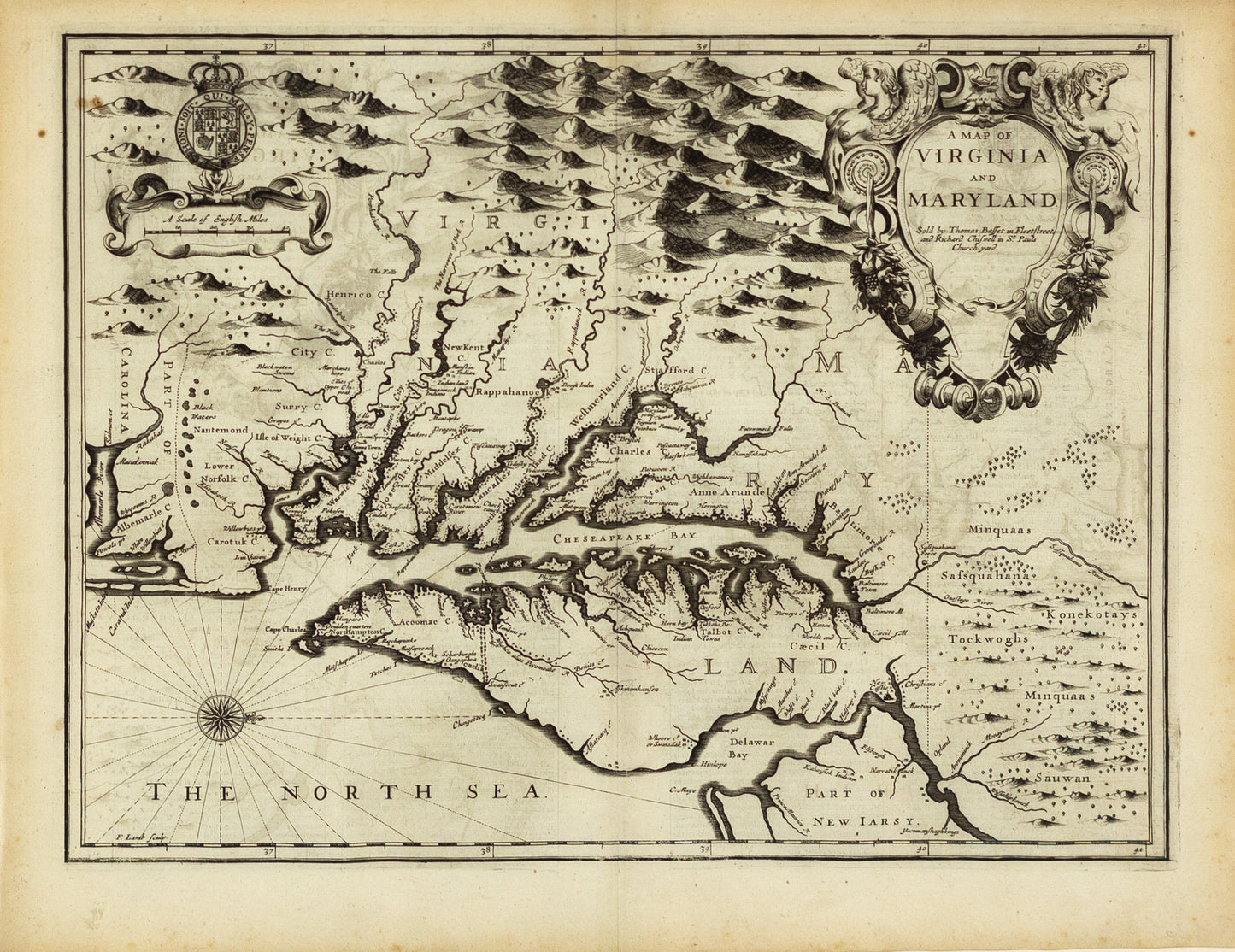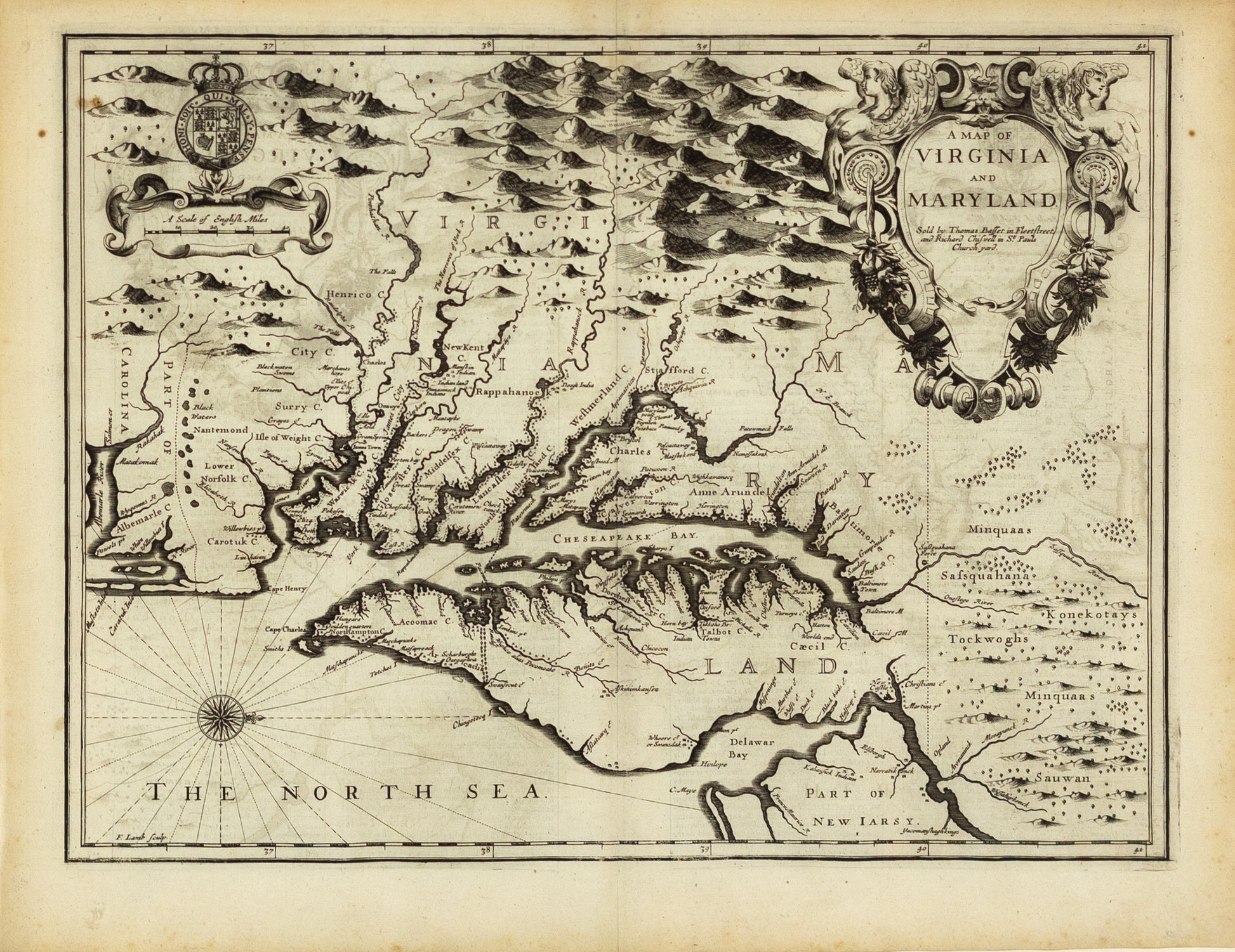
Speed, John. A Map of Virginia and Maryland. London, 1676.
Speed, John. A Map of Virginia and Maryland. London, 1676.
Couldn't load pickup availability
John Speed
A Map of Virginia and Maryland
London, 1676
17" x 22"
Nice example of John Speed's map of Virginia and Maryland, which was engraved by Francis Lamb and first appeared in the enlarged edition of Speed's Atlas in 1676.
Speed's map of Virginia and Maryland is one of the first to incorporate the information from Augustine Herrman's Virginia and Maryland As it is Planted and Inhabited this present Year 1670 Surveyed and Exactly Drawne by the Only Labour & Endeavour of Augustin Herrman Boehemiensis, a few years prior to the Speed map's publication. Fascinating description of the Maryland and Virginia in English text on the verso.
The majority of the cartographic information derives from John Smith's earlier map of Virginia. Speed's 4 maps of the English colonies in America hold the distinction of being the first "new" set of printed maps of the Colonies to appear in a commercial atlas after the English took control of what would become the British Colonies in North America and later the first 13 states (although in truth there are Francis Lamb's maps, prepared for Thomas Bassett and Richard Chiswell, as Speed had been dead for half a century by the time these maps were engraved.